
In a major boost to the Indian defence forces’ quest for an uninterrupted access to the satellite navigation capability to realize their strategic objectives speedily and efficiently, the sixth satellite in the seven spacecraft Indian Regional Navigation Satellite System (IRNSS) constellation that would serve as an independent, full fledged space navigation platform, was successfully launched in March.
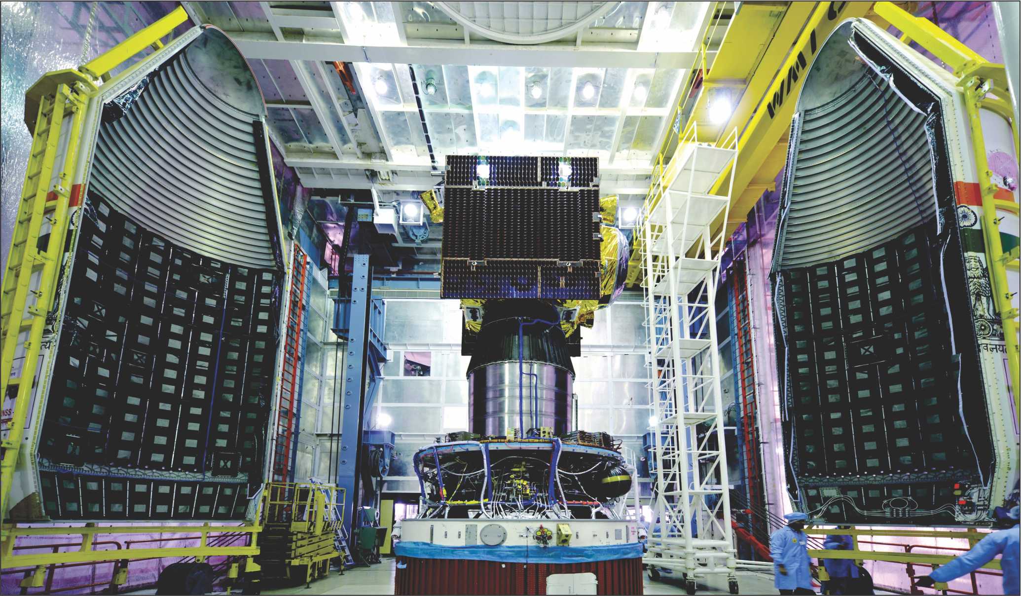
This sixth dedicated navigation satellite in the series, IRNSS-1F, was launched by means of an augmented version of the four stage, reliable space workhorse Polar Satellite Launch Vehicle(PSLV).In less than twenty minutes of its smooth take off from the second launch pad of the Satish Dhawan Space Centre (SDSC), the Indian space port in Sriharikota island, located 90-kms to the north of Chennai, the XL version of PSLV injected the 1425kgIRNSS-1F satellite into a sub geosynchronous transfer orbit with a perigee of 284-km and an apogee of 20,657-km. The satellite, designed for a life span of twelve years, has now joined the five other satellites in IRNSS constellation which are already functional.
All the seven satellites in IRNSS constellation will have continuous radio visibility with the Indian control station and transmit signals using codes and data in S band and L band. Indian Space Research Organization (ISRO) has in the meantime hinted that depending upon the developments in the future, the scope of the seven spacecraft IRNSS would be expanded with more satellites that would ultimately help extend the range of the service area of the Indian satellite navigation platform.
Satellite navigation
Indeed the difficulties that India experienced in accessing the restricted services of the US controlled GPS, especially for military applications like firing of the missiles and precision weapons at the enemy targets underlined the strategic importance of owning and operating an independent satellite navigation system with round the clock functional efficiency. And this exactly was the reason why India decided to develop, launch and operate its full- fledged satellite navigation system. And here lies the genesis of IRNSS.
The last and seventh satellite of the constellation IRNSS-1G was too launched recently. The full fledged IRNSS constellation with seven operational satellites could help sharpen the combat edge of the Indian defence forces. Some of the advantageous features of IRNSS include highly accurate position, velocity and time information data with a good accuracy for a single frequency user with the help of ionospheric correction and an all weather round the clock operation.
Of course, under an agreement that India had signed with Russia sometime back, Indian defence forces are allowed access to make use of the potentials of Russia Glonass satellite navigation system for purposes such as firing a long range missiles including the Indo-Russian supersonic cruise missile Brahmos. Access to more than one satellite navigation system, especially during the times of “crisis and emergency” could help Indian defence forces derive tremendous strategic advantages and stay combat fit.
According to a study by Frost and Sullivan, ensuring interoperability among the global navigation satellite constellations and integrating their services was going to be a major factor in fully realizing their potentials. Experience reveals that interoperability among the global navigation constellations makes for a greater reliability and enhanced accuracy. Indeed, under situations where signals from one set of constellation would be difficult to access on account of the technical reasons and geographical factors, a receiver capable of accessing multiple systems can prove its mettle excellently well.
By all means, India has notched up the distinction of being the sixth country in the world to demonstrate the capability to design, build and operate a sophisticated satellite navigation system. The importance of IRNSS lies in the fact that it would free the country from its dependence on American GPS system. IRNSS is similar to the other global satellite navigation systems including GPS of USA, Glonass of Russia, Galileo of Europe and Beidou of China.
While the navigation payload of the IRNSS spacecraft is designed to transmit navigation service signals to the users in L5 and S bands, the ranging payload made up of a C-band transponder would facilitate the accurate determination of the range of the satellite. Significantly, a highly accurate Rubidium atomic clock, forming a part of this satellite, is a vital component that would make available time and location signals to users on land, sea and air. In addition, IRNSS satellites carry a Corner Cube Retro Reflector for laser ranging.
The IRNSS spacecraft constellation is designed to provide accurate position information service to users in India as well as the region extending up to 1500 km from its boundary. Further, the IRNSS constellation is equipped to provide a Standard Positioning Service (SPS) and Restricted Service(RS) and is expected to provide a position accuracy of better than 20-m in the primary service area(India).
Boosting capabilities
For the Indian defence forces, the availability of a home grown, exclusive navigation satellite system would be a big morale booster. For it was the non availability of a satellite based navigation service that had hindered Indian army’s intelligence missions before and during the 1999 short lived Kargil war with Pakistan. However, with IRNSS in place, Indian defence forces will not have problems locating targets, navigating the movement of troops and supplies and launching precision weapons with a high degree of accuracy at enemy targets.
An independent satellite navigation capability is also critical for the Indian defence establishment’s plan to refine and enhance the network centric warfare capabilities of the Indian defence forces. Similarly, a well endowed satellite navigation capability is also critical for the proposed tri service Indian aerospace command, the formation of which is awaiting clearance from the Indian Government. For the defence forces, in the thick of operations in the remote and difficult to access war zones, a GPS system similar to IRNSS enables locating objects and landmass in the darkness and paves the way for coordinating the troop movements in a hitherto unfamiliar area in addition to facilitating reconnaissance as well as search and rescue operations.
All said and done, there is no denying the point that an independent satellite positioning system like IRNSS cannot but be a valuable, strategic asset for the country, especially during the times of crisis when the possibility of international navigation satellite operators denying access for their service cannot be discounted. Clearly and apparently, continuous and uninterrupted access to exclusive, dedicated navigation satellite systems, has now become indispensable for the combat aircraft, naval warships and ground based troops to acquire a head start in the battle zone and ultimately stay at the winning edge of the war.
For India, which is all poised to position itself as a technological and military super power in the none too distant a future, the need to own and operate an independent navigation satellite system has become the paramount need of the hour.
While India is now close to meeting the satellite navigation needs of the defence forces to a large extent, the same cannot be said of the satellite resources for uses such as communications, surveillance, reconnaissance, electronic intelligence, weather forecasting and ocean watch. All the three services have projected their individual needs of the satellite resources in the years ahead with a view to sustain, refine and boost their combat capabilities.
As it is, for long the Indian forces did feel terribly disadvantaged by the non availability of accurate signals from GPS system on a sustained basis. Indeed, as strategic analysts point out, proper navigation in an unfamiliar territory that is devoid of easily identifiable landmarks is fundamentally vital for the successful accomplishment of reconnaissance missions and well planned military operations.
During India’s 1999 Kargil conflict with Pakistan, Indian patrols operating in the rugged and difficult to negotiate terrain along the Line of Control(LOC) initially strayed into enemy held territory with disastrous consequences. However the subsequent availability of hand held GPS receivers proved to be invaluable for the special task forces and crack teams engaged in identifying targets and destroying enemy installations.
NCW capabilities
In a military scenario, potential targets need to be constantly tracked before they are flagged as hostile and engaged by various weapons system sand it is here that GPS system assumes significance. By feeding the GPS derived data, weapons such as smart bombs, projectiles and even cruise missiles could be guided to hit enemy targets with a high degree of precision.
As it is, most of the combat aircraft now come equipped with GPS gadgets not only for guiding the flight of the aircraft under the cover of darkness, haze and cloud but also to use weapons and ammunition with a vastly enhanced efficiency.
At the end of the day, the GPS capability in tandem with GIS (Geographic Information Service) could help military planners view, plan, interpret and visualize data in ways that reveal solution and intelligence as never before. Not surprisingly then satellite navigation potentials that could be easily accessed have become a critical input for the defence forces either planning a full fledged conventional war or a low intensity conflict.
The stunning effectiveness of the American GPS was demonstrated during the “Desert Storm” operations of 1990-91 that was aimed at freeing Kuwait from the control of invading forces from the neighbouring Iraq. Here the potentials of the American GPS was mainly pressed into service to guide bombers to targets, allow infantry and armored units to locate their bases in frightening, formidable expanse of the desert and position artillery in a war zone ideally suited to fire at enemy lines apart from precisely navigating the missiles to chosen targets.
Similarly, the US led allied forces during their operations in both Afghanistan and Iraq relied heavily on satellite navigation capabilities with hand held portable GPS devices to realize their strategic goals in a rapid and efficient manner. By all means GPS is considered a veritable force multiplier by the defence forces in the battlefield .Moreover, it has also been instrumental in shaping the contours of precision warfare.
From the perspective of the Indian defence forces, the IRNSS capabilities can be of immense utility in refining the network centric warfare techniques. Further, the proposed tri service aerospace command, the setting up of which is yet to get green signal from the Indian government, would need a large and independent satellite navigation capability that can be accessed anytime to boost its combat edge in all its manifestations. With IRNSS in place, Indian defence forces will not have problem locating targets, navigating the movement of troops and supplies and launching precision weapons with a high degree of accuracy at enemy targets.
An independent satellite navigation capability is also critical for the Indian defence establishments’ plan to refine and enhance the network centric warfare capabilities of the Indian defence forces. Similarly, a well endowed satellite navigation capability is also critical for the proposed tri service Indian aerospace command ,the formation of which is awaiting clearance from the Indian Government . For the defence forces, in the thick of operations in the remote and difficult to access war zones, a GPS system similar to IRNSS enables locating objects and landmass in the darkness and paves the way for coordinating the troop movements in a hitherto unfamiliar area in addition to facilitating reconnaissance as well as search and rescue operations.
The uninterrupted access to a dedicated navigation satellite system, has now become indispensable for the combat aircraft naval warships and ground based troops to acquire a head start in the battle zone and ultimately stay at the winning edge of the war. Not surprisingly then the Indian defence establishment has also expressed its keenness to access the satellite navigation capabilities put in place for GAGAN (GPS Aided Geo Augmented Navigation) meant to support, and manage the civilian air traffic over the Indian skies and adjoining areas.
As strategic analysts point out, much the same way as civilian aircraft are navigated by the GPS capability, combat and military transport aircraft and helicopters could be guided through a satellite navigation system for landing and take off and also to hit the designated enemy targets with a deadly effect. Significantly, GAGAN capabilities can be harnessed for by the Indian defence forces for uses such as launching high precision weapons systems including long range strategic missiles with a high degree of precision and efficiency.
In the ultimate analysis, a synergistic exploitation of the potentials of GAGAN and IRNSS can prove to a win-win development for the Indian defence forces. Access to GAGAN supported by navigation payloads carried on board GSAT-8,GSAT-10 and GSAT-15 satellites makes immense strategic sense for the Indian defence forces on the lookout for a second standby navigation system to sustain its operations without hindrance.