
Spectrum of signals
Over the years as its satellite launch facilities grew and matured India has been toying with improvements to the Global Positioning System of the US and the Russian Global Navigation Satellite System (GLONASS) with the intention of creating its own Indian Regional Navigational Satellite System (IRNSS) consisting of seven satellites and a ground support system which is expected to be completed by 2014.
Given the drift of developments it appears that nations intent on adding the nuclear dimension to their arsenals tend to opt for autonomous regional navigation and guidance systems in the expectation that the all pervasive US-owned Global Navigation Satellite System or GPS can deny access during hostilities.
India, long a victim of the hostile intentions of its two major neighbors, has thought of creating its own regional navigational system just as China is doing in its own national interest.
The stated goal is to create a complete system with satellites, ground control equipment and user receivers built within the country. To that end India set in motion at the beginning of the new millennium plans to augment GPS signals over its airspace and large parts of the Arabian Sea and the Bay of Bengal.
Recent developments
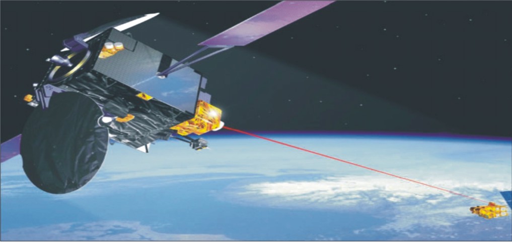
It began work on what is called the GPS-aided GEO-Navigation (GAGAN) system in collaboration with the US Raytheon Company which completed the network in 2007 allowing for better control of international and domestic flights in the approach, terminal taxiing and parking segments. GAGAN monitors GPS satellite signals for errors and then generates correction messages to improve positioning accuracy for airlines and ground staff.
Under the project the Indian Space Research Organization and the Airports Authority of India have been expanding the existing ground network, adding redundancy to ensure uninterrupted service.
It has produced the certification analysis and documentation for safety-of-flight commissioning in a step by step manner to cover all the major airports in the first instance and then the subsidiary ones over time.
The Indian Regional Navigational Satellite System is, therefore, a continuum of solutions to India’s requirements in the 21st century and beyond. Like the original GPS the Indian system will be a dual-use system-a Standard Positioning Service for civilian use and a coded Restricted Service for the use of the military and para-military services.
India has concomitantly retained its interest in the Russian GLONASS as well as the in-progress 30-satellite Galileo project being set up by a European consortium.
The Indian Regional Navigational Satellite System will consist of seven indigenous satellites containing atomic clocks and electronics to generate navigation signals with continuous “radio visibility” with Indian ground control systems operating in the S-band of the electromagnetic spectrum.
The IRNSS is intended to provide position accuracy of less than 20 meters across India and over an area within a radius of 2000 kms around it covering large parts of China and Pakistan in the process.
Three of the Indian satellites will be placed in Geostationary Earth Orbit (GEO) and the other four in Geosynchronous Orbit (GSO).
The ground system will consist of a Master Control Centre that will track the positions of all the IRNSS satellites, calculate the integrity of their atomic clocks, make ionospheric and clock corrections and run the navigation software.
Other ground stations spread around the four corners of the country will track the orbits and the health of the satellites and counter-check the accuracy of the on-board clocks and precision equipment.
Much of what is being done is a replication of how the Global Positioning System was conceived and implemented. In America too the basic requirement was for a failsafe system to pinpoint the location of its own submarine fleet that formed part of the triad of nuclear weapons.
The submerged existence of the submarine fleet required that they are contactable at a moment of international crisis for the success of the concept known as mutual assured destruction on which the concept of nuclear deterrence was based.
In hindsight it was the fear of assured mutual destruction that created an ambiance of stability between the eastern and the western military blocs – NATO that continues to exist even after the end of the Cold War and the Warsaw Pact that has disappeared from the face of the earth after the collapse of the Soviet Union.
It is not without significance that India too is following the same path given that the third dimension of its nuclear weapons capability-the undersea launch facility – is on the verge of coming to fruition with the commissioning of the indigenously developed Arihant nuclear propelled submarine and the leasing of the INS Chakra (ex-Nerpa) from the Russian Federation.
Both will be armed with the indigenously developed Shaurya missiles that will have a range of 750 km which would bring the most economically productive segments of Pakistan within reach of India’s submarine-based missiles.
Regional network
The Indian Regional Navigational Satellite System too will have a civilian accessible segment and an encrypted spectrum that will be for military use only, very much as was done in the US GPS system.
China too is following the same pattern. It is working on both a regional network –Beidou, a regional network that is fully functional – and a global network – COMPASS which is expected to be operational by 2020.
Here too while the similarities with a requirement for a regional network on which the localized submarine fleet is to operate with its arsenal pointed at India China’s requirement for a GPS of its own is intended as a counter to the US with which it shares the Pacific Ocean.
India, on the other hand, has no such global compulsions. At the most it would need to add four more satellites to its regional navigation network to be able to cover the South China Sea.
There it would need to post at least one of its nuclear propelled and armed submarines to add to the deterrent value of its nuclear arsenal the land-based version of which this month has been confirmed to be capable of more than 5,000 km, bringing Beijing and Shanghai within its reach.
However, it needs to be remembered that nuclear armed missiles do not need to use the GPS for navigation.
That is taken care of by the inertial navigation system that is carried inside the missiles in a strap-down configuration with correctives in course induced by its onboard computers and its ring laser gyroscopes.
It is mainly in the need to relay a command to a submerged submarine to activate its missile system that the secured and encrypted GPS connection is needed.
Nonetheless, a regional navigation satellite system like the one India is setting up has its uses in the Ballistic Missile Defence system that India is in the process of creating in a parallel project to the land-based long-range ballistic missile project of which the Agni-V is the culminating point.
This is because India has no enemies beyond that range though, theoretically, the missile is capable of hitting parts of Europe and West Asia as well.
In the Ballistic Missile Defence role a regional navigation satellite system would be useful in detecting the flash of a missile launch (a special spectral scanner that can be incorporated to complement the position charted by the GPS).
Through Mission Control, alert interceptor missile batteries can destroy the incoming missile either outside the atmosphere (exo-atmospheric interception) or within the atmosphere (endo-atmosphere) depending on the trajectory of the enemy missile.
With acknowledged capabilities in both missile launch and satellite production India is well on its way to creating a viable nuclear shield even as it improves its conventional capabilities.