Satellites are playing an increasingly important role in determining the outcome of the modern day warfare that is heavily reliant on C4I (Command, Control, Communications, Computers and Intelligence) strategy.
By serving as ‘command posts’ and eyes and ears in outer space, satellites can aid the armed forces in coordinating their plan of action and synchronise their operations for boosting their fighting capability through enhanced situational awareness.
For the network centric warfare strategy that draws heavily from C4I, satellite resources cannot but be an invaluable asset.
Indeed, satellites, computers and communications network that help in the seamless integration of fighting platforms, command centres and defence forces are all critical for the successful network centric battlefield strategy.
Not surprisingly, there is now an all round appreciation of the need to harness the potentials of “space resources” to stay at the winning edge of the war.
From fighting a conventional warfare involving forces from all the three services to tackling a low key conflict highlighted by guerrilla tactics, satellites have become an indispensable tool to stay ahead of the adversaries under the tense battlefield conditions.
By all means, high performance satellites meant for a variety of end uses could be a major game changer for the defence forces equipped to harness the potentials of C4I in a big way.
All such operations can be conducted such as weather satellites providing forecast of climatic conditions that facilitate bombing raids and missile launches, navigation satellites guiding lethal weapons to designated locations, reconnaissance satellites locating the exact geographical position of military targets, electronic ferret satellites collecting data on radio frequencies.
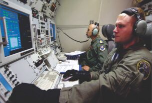
Also, communications satellites providing real time, secure links between defence forces scattered over a vast geographical swathe for a co-ordinated strategy and ocean watch satellites snooping on the naval movement of adversaries, have all become puppets on a string of modern day warfare with a strong focus on C4I.
Since space assets have become an integral part of the battlefield strategy, control of outer space is as critical as the control of high seas and air space in so far as establishing the battlefield supremacy is concerned.
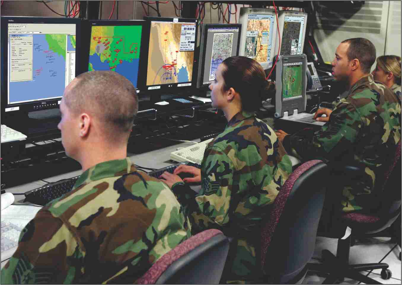
At the end of the day, satellites hold the key for a well co-ordinated and synchronised operations of the battlefield strategy by seamlessly integrating weapons platforms, missiles, radars and sensor suits, UAVs, weaponised drones, electronics and communications network, fighter jets, transport aircraft, logistics and support systems and defence forces spread across a vast geographical swath for sustaining “strategic superiority” at all levels of battlefield.
Kargil experience
It is the poor access of Indian defence forces to C4I resources during the 1999 short lived Kargil war which had resulted in crack teams of Indian Army initially straying into the enemy held territory with disastrous consequences.
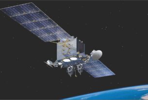
The Indian Navy, youngest of the three services with a strong focus on meeting many of its requirements through indigenous sources, has taken a big leap forward in strengthening its C4I capability with the acquisition of GSAT-7 multi- band advanced communications satellite launched in August 2013.
Clearly, GSAT-7, which is India’s first dedicated military satellite, has provided Indian Navy a safe and reliable communications capability to efficiently network its offshore and onshore resources.
Indeed, with its 2,000-milies nautical footprint over the strategically situated Indian Ocean Region (IOR), GSAT-7 will help the India Navy network all its warships, submarines, aircraft and UAVs along with its ground based “assets and resources”.
Needless to mention, GSAT-7 also provides the Indian Navy the necessary level of expertise for its seamless integration into the tri service aerospace command, the formation of which is awaiting clearance from the Indian government.
In particular, GSAT-7 will serve as a sensitive command post in outer space over IOR and help transform the entire maritime domain awareness of the Indian Navy.
With GSAT-7 potentials, Indian Navy would be in a position to get a digital tactical battlefield view of the dispersed fleet formations, aircraft locations and even submarines moving swiftly in the depths of the ocean.
By all means, GSAT-7 marks a small step towards Indian navy’s strategy of transforming itself into a satellite augmented, network centric, three dimensional, blue water maritime force.
The eight decades plus old Indian Air Force (IAF) which is up against squadron depletion would be the next to get a exclusive defence satellite designed to meet its growing C4I requirements.
As things stand now, GSAT-7A, similar in capability to GSAT-7 is planned to be launched in the near future for the exclusive use of IAF.
As it is, IAF has been able to take giant strides in preparing itself for net-centric operations with the rolling out of the fibre optic based Air Force Net (AFNET) on which the Integrated Air Command and Control System (IACSS) rests.
Satellite capability could boost the potentials of IACSS in a big way. For the Indian Army, which has the onerous responsibility of safeguarding a long and porous international border interspersed with hot, air deserts and snow capped mountain ranges, a well endowed network of satellites for variety of end uses is a vital requirement.
Dedicated capability
In a development that would boost the intelligence gathering capability of the Indian defence forces, Defence Research and Development Organisation (DRDO) has unveiled a plan for building an electronic intelligence (ELINT) satellite for the exclusive use of the Indian defence forces.
This satellite featuring a Synthetic Aperture Radar (SAR) will be located in low earth orbit, which will be useful for intelligence gathering along India’s international borders with China and Pakistan.
Significantly, this satellite is being equipped to collect data on round the clock basis and even under the cover of darkness, haze and dust storm.
According to fifteen years’ Technology Perspective and Capability Road Map (TPCR) unveiled by the Indian Defence Ministry, in keeping with the global trends, it would be ideal to go in for developing and deploying small and inexpensive satellites for boosting the intelligence gathering capability of the Indian defence forces.
Significantly, Cartosat-2 series of satellite, an advanced earth observation platform, launched by the four stage, Indian space workhorse PSLV (Polar Satellite Launch Vehicle) on June 2016, could very well be a major contributor to Indian military’s reconnaissance, surveillance and intelligence capabilities.
Interestingly, the Cartosat-2 satellite has an in built capability to snap high resolution images of earth’s surface along with an ability to take videos which it can compress and send back to earth.
It features a panchromatic camera and a high resolution multi spectral imaging system. The sub milli-meter resolution and a quicker revisit capability are among the advantageous features of this satellite.
For many years now, Indian Army has been routinely using data from IRS and Cartosat series of remote sensing satellites being operated by the Indian Space Research Organisation (ISRO) for surveillance, reconnaissance and intelligence.
The futuristic Cartosat-3 spacecraft system of ISRO will be a hyper spectral imaging platform capable of providing high resolution, multi scene images of the areas of interest.
The GSAT-6 advanced communications satellite launched by means of the August 27, 2015 mission of the three stages Geosynchronous Satellite Launch Vehicle (GSLV) will help the Indian defence forces enhance its situational awareness through its multimedia broadcasting capability.
Digital solutions
The digital compression technique featured by GSAT-6 makes for its vastly enhanced data carrying capacity. Significantly, this high powered satellite has a built in capability to communicate with the small, hand-held terminals.
The capability of GSAT-6 for two way transmission of voice, video and data in a secure mode fits in well with the strategic communications philosophy of the Indian defence forces.
This feature would be particularly beneficial for the armed forces keen on getting a holistic battlefield view.
The potentials of GSAT-6 can also be harnessed for boosting the rapid strike capability of the defence forces through the timely acquisition of relevant information.
For the defence forces operating in remote and difficult to reach areas, the GSAT-6 would enable establishing a hassle free communications link.
What is more, the GSAT-6 capability can also be exploited for strengthening the network centric warfare strategy.
The putting in place of the seven spacecraft Indian Regional Navigation Satellite System (IRNSS) by ISRO has proved to be a major game changer for the Indian defence forces.
This home grown space based navigation system named NAVIC will help Indian defence forces located along the international borders get situational directionto plan their operational strategy.
Further, IRNSS can be used to monitor landslips and for surveillance and reconnaissance as well as search and rescue operations.
An independent satellite navigation capability is also critical for India’s plan for boosting its network centric warfare capabilities.
Similarly, satellite navigation capability is also crucial for the proposed tri service Indian aerospace command.
For the defence forces, in the thick of operations in the remote and difficult to access war zones, IRNSS could help locate objects and landmass in the darkness and pave way for co-ordinating the troop movement in a hitherto unfamiliar territory.
Indeed, a GPS system like IRNSS, can be a great enabler for the defence forces fighting it out to turn the tide of the warfare.
The stunning effectiveness of the American GPS was demonstrated during the desert storm operations of 1990-91 that was aimed at freeing Kuwait from the clutches of Iraqi occupation forces.
In this context, the potentials of GPS was mainly pressed into service to guide bombers to targets, enable infantry and armoured units to locate their bases in frightening featureless expanse of the desert and position artillery in a war zone ideally suited to fire at enemy lines apart from precisely navigating missiles to pre-determined targets.
Much the same way as the civilian aircraft are being navigated by GPS, combat and military transport aircraft and helicopters could be guided through a satellite navigation system to land and take off and also hit targets with deadly effect.
The significant impact of space assets on military power in US and the ambitions of many other nations in Asia to give a defence edge to their space programme has been noticed by the Indian defence establishment.
Indeed, the difficulties that India experienced in accessing the restricted services of the US owned GPS especially for military applications underlines the strategic importance of owning and operating an independent satellite navigation system.
In keeping with the global trends in military communications, the futuristic communications satellites designed for the use of Indian defence forces will make an enhanced use of Ka-band frequency to ensure security and provide a greater bandwidth.
Use of higher frequency bands including Ka and X makes for enhanced security of a satellite communications system.
By all means, the safety and security of information made available by satellites should be ensured to avoid the possibility of interception by adversaries.
Of course on its part, DRDO has unveiled a plan to build and launch a series of defence satellites with surveillance, imaging and navigation capabilities to cater to the needs of the three wings of services.
For the Indian defence forces, satellites are crucial for improving the operational trimness of C4Isystem. For there is no denying the point that the future of the warfare is tied to C4I capability.