Avenues in space
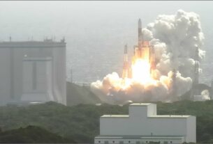
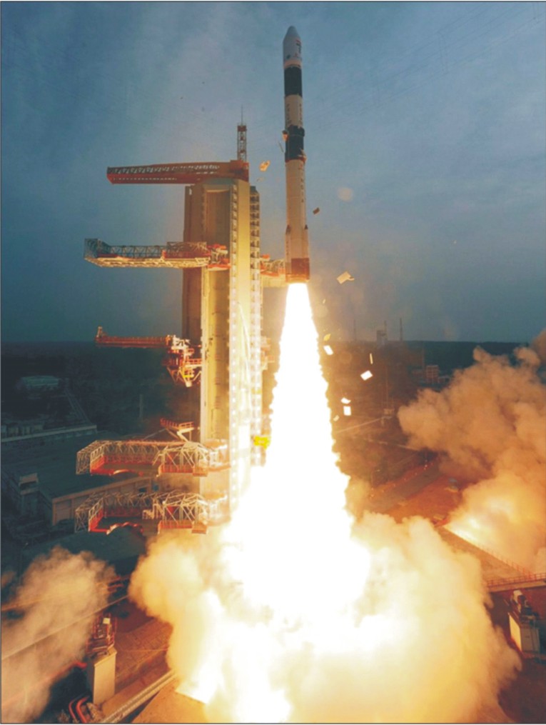
The smooth launch of India’s home-grown 1858-kg radar imaging satellite RISAT-1 by means of XL version of the four stage Polar Satellite Launch Vehicle (PSLV) on April 26 from Satish Dhawan Space Centre (SDSC), the Indian spaceport in Sriharikota Island on India’s eastern coast, is considered a major boost to India’s defence and security capabilities in all their manifestations.
Defence analysts point out that the data made available by RISAT-1 can be exploited for enhancing the surveillance level along India’s international borders. RISAT-1, which is the heaviest satellite to be launched by means of PSLV featuring alternate liquid and solid fuel driven stages, provides India with day and night as well as all weather earth imaging capability.
Technological breakthrough
However, K Radhakrishnan, Chairman, Indian Space Research Organisation (ISRO) brushed aside the suggestion that RISAT-1 potentials could be used for reconnaissance.
He drove home the point that RISAT-1 cannot be classified as a “spy satellite” since it features a C-band Synthetic Aperture Radar (SAR) in distinct contrast to the X-band SAR incorporated in RISAT-II which ISRO had realized in association with the Israel Aerospace Industries (IAI).
Giving details, Radhakrishnan noted that RISAT-1, which will be finally positioned at an altitude of 536-km, will help India get an accurate data on area under crops like paddy.
In fact, G Madhavan Nair, predecessor of Radhakrishnan, after the RISAT-11 launch in April 2009, had also denied the suggestion that RISAT-II can be used for spying and surveillance.
For ISRO, RISAT-1 marks a major technological breakthrough in terms of mastering the knitty gritty of designing and developing an advanced radar imaging satellite with all weather capability.
RISAT-1 would also help ISRO develop more refined microwave imaging satellites for meeting the growing reconnaissance needs of the Indian defence forces.
As it is, only a handful of countries in the world have demonstrated a capability to build a technologically advanced radar imaging space platform.
It is an open secret that most of the civilian remote sensing satellites double up as “free wheeling spies in the sky.” The US Landsat series of remote sensing satellites were the striking example of this inescapable reality.
For remote sensing and reconnaissance are considered the two faces of the same coin. And a radar imaging satellite like RISAT-1 could come in handy for Indian defence forces to collect data of relevance round the clock even under conditions of cloud, haze and dust.
In the immediate future, RISAT-1 will help India considerably reduce its dependence on the data from the Canadian Radarsat-II satellite.
According to ISRO, RISAT-1 data could prove quite useful in areas such as soil moisture estimation, crop growth monitoring, food grains yield forecast as well as mapping and management of natural disasters.
In addition, RISAT-1 data can also be exploited for glacier studies, estimation of snow melting in summer, terrain mapping and forestry studies.
For Indian defence set up, RISAT-1 data can help zero in on the movement of terrorists and militants across the international borders on round the clock basis.
Powerful tool
Indeed, a radar imaging satellite is considered a powerful tool of surveillance. According to Prof Bhupendra Jasani of the Department of War Studies of the London based King’s College, a radar satellite can also be exploited for monitoring naval movements.
This implies that RISAT-1 data can help Indian security forces improve their coastal surveillance strategy in a substantial manner.
Indeed, research efforts are on to develop powerful space based radar instrumentation systems capable of penetrating the dense thermal layers of the oceanic surface to zero in on the movement of submarines.
As it is, India’s Defence Space Vision 2020 envisages the need to strengthen the satellite based intelligence, reconnaissance, surveillance, communications and navigation capabilities of the Indian defence forces.
In the ultimate analysis, only a coordinated and integrated use of various types of satellites could help Indian defence forces to face the security challenges with a greater degree of confidence.
However, excepting for RISAT-1 and RISAT-II radar imaging satellite that ISRO had realized in association with Israel Aerospace Industries (IAI) all other satellites in IRS (Indian Remote Sensing Satellite) constellation are passive systems based on optical imaging that make use of the solar radiance.
The IRS made up of as many as eleven satellites is considered the largest constellation of remote sensing satellites in the world. Of course, the Indian defence forces continue to make limited use of the data from optical remote sensing satellites in IRS constellation for strategic and intelligence gathering purposes.
As things stand now, Indian defence forces could stand to benefit enormously from ISRO’s plan to put in place seven spacecraft network of navigation satellites under the IRNSS (Indian Regional Navigation Satellite System) project by the middle of this decade.
Significantly, the first of the IRNSS satellite is expected to be launched during 2012-13. The IRNSS constellation would provide two services – standard positioning service for civilian users and encrypted restricted service for defence forces.
Reliable and uninterrupted access to satellite navigation holds the key to a successful net-centric warfare strategy.
In the immediate future, Indian defence forces can fall back on “smart eye in the sky” in form of RISAT-1 to enhance their situational awareness and intelligence gathering capability.
Indeed, following the massive intelligence failure suffered by Indian defence forces before and during the 1999 Kargil conflict with Pakistan, Indian Army has been projecting the need for getting an uninterrupted access to a range of high resolution earth imaging space platforms to prepare itself to face any eventuality and avert Kargil like fiasco.
Currently, Indian defence forces have limited access to the IRS constellation of earth observation spacecraft.
The Cartosat series of satellites being operated by ISRO are particularly relevant to Indian defence forces for terrain modelling and understanding the landscape features in great depth.
Moreover, only an exclusive and dedicated network of remote sensing satellites providing images in different spatial and spectral resolutions could alone meet the growing needs of the Indian defence forces.
Indeed, the C-band SAR payload of RISAT-1 operating in a multi polarization and multi resolution mode is equipped to provide images with coarse, fine and high spatial resolutions.
The active phased array technology of the SAR payload however uses TR (transmit and receive) modules to provide necessary electronic agility for achieving the multi-mode capability to provide spatial resolutions of 1-m to 50-m and a swath of 10-240 km.
This caters to a wide ranging application. Being an active radar sensor operating in the microwave region of electro magnetic spectrum, SAR provides target parameters such as dielectric constant and surface roughness.
The 300-kg RISAT-II microwave imaging spacecraft carrying an X-band SAR payload launched by means of PSLV was realized on a fast track mode in response to the insecurity complex generated by the 26/11 Mumbai terror attack.
The all weather RISAT-II has been described by the strategic analysts as a high tech space platform designed to enhance the reconnaissance capability. RISAT-II’s revisit capability of four to five days is considered an advantageous factor in the dynamic monitoring of the developments of strategic importance.
Added to that, the highly agile RISAT-II can be manoeuvred to change its viewing angle as per the requirements of the users. Meanwhile, there are reports to suggest that Israel has acquired RISAT-11 by paying India US$100-million.
At the moment, Indian defence forces do not have a dedicated satellite systems meant for surveillance, reconnaissance and intelligence gathering.
Of course, the ISRO built GSAT-7 satellite which is expected to be launched sometime next year will serve as Indian Navy’s exclusive space platform for reliable, robust and fool proof communications.
Ambitious plans
Meanwhile, Defence Research and Development Organisation (DRDO) has unveiled an ambitious plan for a series of satellites for a variety of uses for supporting the three wings of the services.
In this context, Hyderabad based Defence Electronics Research Laboratory (DLRL) of DRDO had hinted at a project for developing a high performance Electronic Intelligence (ELINT) satellite capable of monitoring trouble spots along India’s international borders.
The payload of this satellite is to be developed by DLRL. With this satellite, Indian defence forces will be in a position to obtain a fairly good “intelligence picture” of the build up across Indian borders with China and Pakistan.
This satellite is planned to be launched by means of PSLV sometime during the middle of this decade. Significantly, this satellite is likely to be followed by the development of an exclusive Communications Intelligence (COMINT) satellite for the use of the Indian armed forces.
Beyond building service payloads, DRDO will have to depend on ISRO for the realization of fully integrated satellite systems and also for getting them off the ground.
However, with its limited infrastructure, ISRO is having tough time meeting its own requirements in a time bound manner.
With a single operational launch vehicle in the form of PSLV and a single launch complex on Sriaharikota Island, ISRO is not in a position to accomplish more than three orbital missions a year.
There is no denying the fact that India would need to build a second launch pad which is very critical to boosting the launch missions by a substantial extent.
However, the successful flight test of India’s most advanced and longest range ballistic missile on April 19 has opened up the possibility of modifying this missile for launching satellites on demand.
Indeed, DRDO would need to build its own launch capability to take care of the growing space defence needs of the country.
For a modified military missile can be deployed for launching satellites at short intervals and on a regular basis. What is more, as pointed out by V K Saraswat, DRDO chief, Agni-V would give India capability to deploy a kill vehicle to take care of the rogue satellites and ensure the safety of Indian space assets.
All said and done, only Israel stands out as a reliable partner in India’s quest to build military satellite capability. For the strides made by Israel in the area of micro miniaturization and radar imaging technology could prove invaluable for India in building state of the art, high resolution satellites for military applications.
Though South Korea and India have an active space cooperation programme, ISRO cannot hope to derive much mileage from its South Korean counterpart in building advanced remote sensing satellites on account of its lack of expertise in this critical area.
And Japan’s essentially pacifist constitution prevents it from collaborating with other countries in building military satellites.
This implies that India would need to strengthen its association with Israel to build better and more sophisticated observation satellites for enhancing the surveillance and reconnaissance capabilities of the Indian defence forces.