Network Centric Warfare (NCW) strategy, which in recent years, has emerged as a major force multiplier in the battlefield operations, draws advantage from the real time sharing of quality information for an enhanced situational awareness through a robust communications network ably supported by a constellation of satellites meant for a variety of end uses.
Indeed, a well endowed information grid is the primary technical framework designed to support NCW. In the ultimate analysis, all advanced platforms, sensor systems and command and control centres, need to be accessed by the defence forces to get a shared awareness of the battle space in a real time and dynamic basis.
There is no denying the point that a robustly networked force improves information sharing. Evidently, quality information sharing leads to an enhanced situational awareness. And an enhanced situational awareness enables self- synchronization, which, in turn, adds to the overall operational capability of the defence forces in the thick of the battle field. NCW capability does indeed prove to be a game changer while facing an enemy who lacks such a capability.
Critical asset
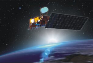
By all means, satellites in a variety of orbits and meant for a wide ranging applications, that serve as “ears” and “eyes “in the final frontiers for the defence forces on the look out for a holistic and dynamic picture of the battle field scenario, are today an indispensable and inseparable part of the NCW.
It is not for nothing that a high performance spacecraft constellation-ranging from lightweight nano satellites in low earth orbit to heavier class communications satellites in geostationary orbit (36,000km above the equator where a satellites appears stationary in relation to earth)-has come to be recognised as the “unseen guide” providing timely and relevant data on a dynamic basis to help the armed forces stay at the centre of the NCW strategy. At the end of the day, there is a growing realization of the fact that without a string of dedicated defence satellites in place, the potentials of NCW cannot be harnessed fully well.
By all means, satellites hold the key for a well-coordinated and synchronized operations of a battlefield strategy by seamlessly integrating weapons systems, missiles, radars and sensor suits, UAVs, weaponized drones, electronics and communications network, combat aircraft, transport aircraft as well as logistics and support system to help the defence forces spread thinly across a vast geographical swathe in sustaining “strategic superiority” at every phase of the battlefield operations.
And herein lies the vital support base for a successful NCW battlefield strategy. Weather watch satellites designed to forecast climatic vagaries to facilitate bombing raids and missile launches, navigation satellites guiding lethal weapons to designated locations, reconnaissance satellites locating the exact geographical position of military targets, electronic ferret satellites gathering radar frequency data, communications satellites providing real time secure links between defence forces stationed across various geographical locations for a coordinated strategy and ocean watch satellites snooping on the naval movement of the adversaries have all become vital components of the network centric warfare.
For the Indian defence forces, the availability of a home grown navigation space platform in the form of Indian Regional Navigation Satellite System (IRNSS) made up of seven spacecraft is a veritable strategic plus point in terms of strengthening of NCW capability. Incidentally, it was the non- availability of a satellite based navigation service that had hindered Indian Army’s intelligence missions before and during the 1999 short lived Kargil war with Pakistan.
But then with the IRNSS constellation in full operational trim, Indian defence forces will find it easy to locate targets, navigatethe movement of troops and supplies and launching surprise attacks on enemy posts.
In fact, the daring and breath taking accomplishmentof the Naval SEALs of the US National Special Warfare Development Group thatled to the assassination of the most dreaded terrorist Osama Bin Laden in Pakistan’s garrison town of Abbottabad in May 2011 stands out a tribute to the perfect coordination realized through the network centric strategy that relied heavily on satellite resources. For the aerial mission involving a well equipped helicopter that was able to successfully evade the detection of the ground based radars in Pakistan and zero in on the target speaks volume for the flawless ground work accomplished through a well planned network centric strategy.
Navigation
There is no denying the point that a full fledged satellite navigation capability is critical for refining network centric warfare capabilities in all their manifestations. For the defence forces in the thick of operations in the remote and difficult to access war zone, a GPS system supported by a sufficient number of satellites enables locating objects in the darkness besides paving the way for coordinating the troop movements in a hitherto unfamiliar area in addition to facilitating reconnaissance as well as search and rescue operations.
Clearly and apparently, continuous and uninterrupted access to exclusive, dedicated navigation satellite systems, has now become indispensable for the combat aircraft, naval warships and ground based troops to acquire a head start in the battle zone and ultimately stay at the winning edge of the war.
While India is now in a position to meet the satellite navigation needs of the defence forces to a large extent, the same cannot be said of the satellite resources for uses such as communications, surveillance, reconnaissance, electronic intelligence, weather forecasting and ocean watch. All the three services have projected their individual needs of the satellite resources in the years ahead with a view to sustain and refine their network centric combat capabilities.
As it is, India’s first full-fledged military satellite, GSAT-7 meant for the exclusive use of the Indian Navy was launched in August 2013. This satellite which has been fully integrated into the network centric operations of the Indian Navy is a multi- band space platform designed to provide secure communications over a wide oceanic swath and the Indian landmass. With a high performance communications satellite at its command, Indian Navy would be in a position to enhance its situational awareness and intelligence gathering capability over the Indian Ocean region where China has stepped up its activities as counterpoise to the Indian naval build up.
With a view to boost its striking punch and expand its area of influence, Indian Navy has implemented a well conceived strategy to link up its long range missiles, radars and air defence systems on all the sea based assets to a central room through the highly reliable communications network provided by GSAT-7.
India’s defence set up has now fully well realized that a satellite based network centric approach helps derive advantages in terms of the ability to stay ahead of an opponent and dictate the dynamics of engagement. Denying the adversaries access to space through the degradation or destruction of his satellite resources has now assumed more than usual importance in the context of NCW strategy.
Right at the moment, Indian defence forces have to make do with limited access to the satellites-most of which are dual use systems-being operated by the Indian Space Research Organisation (ISRO) to meet their strategic and tactical needs. Access to the space platforms on an uninterrupted basis would alone help the forces to obtain battlefield transparency of rival forces, a key element of NCW strategy.
Against this backdrop, Technology Perspective and Capability Road Map (TPCR) unveiled by the Indian Defence Ministry envisages an ambitious plan for a satellite based communications network with high data rates and multi band operations for voice, data and allied applications.
In addition to exploiting the satellite capability for communications and enhancing the situational awareness at all levels of operations Indian defence forces could make use of advances in communications and sensor technologies to give a ‘greater punch and thrust’ to its NCW warfare strategy. However, keeping the information and communications network in operational trim in the context of the expanding scope of “cyber war” has assumed more than the usual significance. In particular, precaution must be exercised to ward off the threat of jamming that satellite communications systems are vulnerable.
To boost the surveillance and reconnaissance capabilities of the defence forces keen on refining the network centric capability, data from the high performance, high resolution earth observation satellites play a key role.
The US and NATO (North Atlantic Treaty Organization) defence forces have access to the real time, dynamic information from a range of remote sensing satellites transmitting data in a variety of spatialand spectral resolutions. For the Indian defence forces located in the mountainous stretches that remain clouded for most parts of the year, data from microwave, radar imaging satellite, RISAT-1 satellite of ISRO cannot but be a valuable asset . There is no denying the point that data from an active, microwave imaging satellite capable of operating on round the clock basis, even under extremes of atmospheric and environmental conditions, could help Indian defence forces to get a “realistic picture” of the strategic scenario in a dynamic mode.
Expanding access
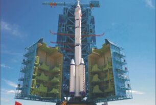
The successful completion of the seven spacecraft Indian domestic satellite navigation system, IRNSS (Indian Regional Navigation Satellite Launch) with the flawless launch of the last of the satellite in the series, IRNSS-1G, by means of an augmented X version of the four stage, reliable Indian space workhorse, Polar Satellite Launch Vehicle (PSLV) on April 28, 2016 is by all means a welcome development for the Indian defence establishment keen on expanding its access to the home-grown satellite navigation system for boosting its combat capabilities and meeting its strategic objectives speedily and efficiently through NCW concept.
Significantly, some of the advantageous features of IRNSS include highly precise position, velocity and time information data with a good accuracy for a single frequency user with the help of ionospheric correction and an all weather round the clock operation. As pointed out by sources in ISRO, the home-grown IRNSS, in distinct contrast to the commercial navigation platforms, would provide signal coverage even in the remote areas of the country with a high degree of precision. This is, in fact, a major striking advantage for the Indian defence forces. IRNSS, a full fledged satellite navigation system similar in capability to GPS of USA and Glonass of Russia was envisioned after the US denied access to the restricted services of its GPS system during the 1999 short lived Kargil war. Incidentally, GPS is under the control of US military.
In a military scenario, potential targets need to be constantly tracked before they are flagged as hostile and engaged by various weapons systems and it is here that GPS system assumes significance. By feeding the GPS derived data, weapons such as smart bombs, projectiles and even cruise missiles could be guided to hit enemy targets with a high degree of precision.
With IRNSS in place, India defence forces will know their positions in remote, areas close to the international borders with a high degree of accuracy and direct their efforts accordingly. Further, IRNSS can be used to monitor landslips and for surveillance in border area. A well endowed satellite navigation capability is critical for the proposed tri service Indian aerospace command, the formation of which is awaiting clearance from the Indian Government.
The stunning effectiveness of the American GPS was demonstrated during the “Desert Storm” operations of 1990-91 that was aimed at freeing Kuwait from the control of invading forces from the neighbouring Iraq. Here, the potentials of the American GPS was mainly pressed into service to guide bombers to targets, allow infantry and armoured units to locate their bases in frightening, formidable expanse of the desert and position artillery in a war zone ideally suited to fire at enemy lines apart from precisely navigating the missiles to well identified, chosen targets. Similarly, the US led allied forces during their operations, in both Afghanistan and Iraq, relied heavily on satellite navigation capabilities with hand held portable GPS devices to realize their strategic goals in a rapid and efficient manner.
The GPS capability in tandem with GIS could help military planners view, plan, interpret and visualize data in ways that reveal solution and intelligence as never before. As it is, most of the combat aircraft now come equipped with receivers to help access navigation services on an uninterrupted basis and smoothly guide its flight under the cover of darkness, haze and cloud besides helping it use weapons and ammunition with a vastly enhanced efficiency.
Over the years, the use of orbiting satellite platforms designed for a variety of end uses to boost the prospects of NCW strategy has been expanding at a phenomenal pace.
Hyperspectral earth observation satellites capable of providing minute and intricate details of an area of strategic significance on a real-time and sustained basis as well as broadband communications satellites transmitting a large volume of data in ultra-high speed frequency-that complement fibre optics cable and broadband terrestrial wireless networks-are rapidly changing the contours of NCW battlefield strategy.
Even a wide range of civilian, commercial satellites designed for a variety of end uses are being harnessed for non -tactical uses by defence forces falling back on NCW strategy. Only sky seems to be the limit in so far as bringing about a radical transformation in the entire spectrum of operations involved in the effective use of NCW strategy under real battlefield conditions by courtesy of satellites. And Indian defence forces should not miss any opportunity of strengthening their NCW capability by drawing mileage from the potentials of advanced satellites featuring latest genre technologies. Of course, India is still a long way off from putting in place an institutional set up fully dedicated to building and launching military satellites of various categories on a continuous and sustained basis.
For such an initiative alone will turn Indian defence forces into a tech military power in tune with the NCW operations.


