In a major policy decision aimed at reaching out to the neighbours, Indian Government has decided to offer the services of Gagan (GPS- aided Geo Augmented Navigation) system designed to support the civil aviation traffic over the Indian skies and in adjoining areas to South east Asian countries to help them generate financial resources and showcase the country’s next generation navigation and surveillance technologies.
Essentially, Gagan meaning sky in Sanskrit is a satellite based augmentation system which helps aircraft navigate and operate smoothly and efficiently by making use of GPS (Global Positioning Systems) signals.
In fact, moments after the successful flight of the four stage Indian space workhorse PSLV (Polar Satellite Launch Vehicle), Prime Minister Narendra Modi while addressing the Indian space community at the spaceport in Sriharikota island had highlighted the need for India to extend the services of India’s home grown navigation satellite system IRNSS (Indian Regional Navigation Satellite System).
Incidentally, two satellites of the seven spacecraft IRNSS constellation being developed by Indian Space Research Organisation (ISRO) to end Indian dependence on US GPS system are already in operation. In fact, it was the difficulties which India had encountered while accessing the US developed GPS especially for defence applications that nudged the country to develop its own satellite navigation system. Civil aviation, marine navigation, road transportation and disaster management are some of the areas that would stand to benefit from the potentials of IRNSS.
Navigational services
On its part, Gagan offers a high degree of accuracy and integrity and continuity of navigation services for various applications in civil aviation sector based on the satellite data. The state owned Airports Authority of India (AAI) which in association with the ISRO developed Gagan system, is expecting the South East Countries to accept the offer made by India to share the “fruits of this navigation system”.
Minister of State for Civil Aviation GM Siddeshwara recently informed the Indian Parliament that it is planned to promote the usage of Gagan in the non aviation sectors too. Some of the areas which will stand to benefit from the potentials of Gagan include vehicle tracking, intelligent highway systems, train tracking, disaster management, search and rescue operations, surveying, land management through terrestrial mapping as well as marine and farming operations.
According to ISRO, the primary objective of Gagan is to establish a certified satellite based augmentation system for navigation services for safety of the applications with required accuracy and integrity and to provide better air traffic management over Indian air space. Rightly and appropriately Gagan has been described as an “eye in the sky” system that has paved the way for doing away with the ground based system involving a huge, costly and complicated network . Gagan will also reduce workload for air traffic controllers and the flight crew. More importantly, it would reduce noise pollution foot print of the civil aviation traffic.
Sources in AAI point out that most conspicuous benefit of Gagan is that it would help reduce fuel consumption by 20% by allowing the aircraft cruise higher and faster and by charting straight routes by circumventing the zig-zag ones. Currently, fuel accounts for half of the operational cost of an aircraft. As such, access to Gagan would help an airline reduce its fuel consumption while increasing its efficiency of operation.
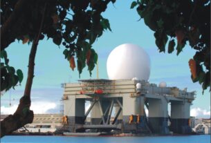
There is no denying the fact Gagan will make Indian skies safer and secure for the aircraft to operate. While landing, Gagan will give an aircraft a range of 20-ft, thus to a large extent reducing the possibility of human error. The ground support system of Gagan which has been provided by the US based defence technology company Raytheon will support the space segment being operated by ISRO.
“We would attract foreign airlines flying from the Gulf to Europe over more efficient air space after the Gagan roll out. This will boost our revenue considerably,” says a functionary of AAI “We may even plough back the greater revenues and lower charges to draw more aircraft traffic.” In particular, AAI is planning to induce Asia Pacific countries to fly their airlines across the Indian airspace. In particular, Gagan is expected to help aircraft operators save time and money spent on fuel by managing climb, descent and engine profiles of the aircraft. This beneficial aspect of Gagan is expected to nudge a number of carriers to use air space covered by Gagan.
Gagan through improved position information permits approaches with vertical guidance, thereby improving access to the airports even under conditions of inclement weather and consequently obviating the diversion of aircraft to other airports .Further, it also reduces of environmental emissions. In addition, Gagan enhances reliability and cuts down on delays in flight and aid passengers by defining more precise terminal area procedures that features parallel routes and optimized airspace corridors.
Providing safety
From safety perspective, Gagan will enhance air to air surveillance and provide minimum safe altitude warning for controlled descent into the terrain. As things stand now, Gagan will make the utilisation of Indian air space more efficient and safer especially above seas, hilly terrain and remote places. According to ISRO, Gagan will ultimately help bridge the gap between EGNOS (European Geostationary Navigation Overlay Service) and Japanese MSAS (Multifunctional Satellite Augmentation System) by providing seamless air navigation services across regional boundaries.
The ground network meant to support Gagan comprises 15 Indian reference stations, three Indian navigation land uplink stations and three Indian mission control centres along with software and communications links. Much the same way as the civilian aircraft are being navigated by GPS, combat and military transport aircraft and helicopters could be guided through a satellite navigation system to land and take off and also hit targets with a deadly effect.
In December 2013, Directorate General of Civil Aviation (DGCA) certified Gagan to RNPO.1 (Required Navigation Performance 0.1 nautical miles) service level. This certification has paved the way for the aircraft fitted with SBAS (Satellite Based Augmentation System 0 to use Gagan signals in space for en-route navigation and non precision approaches without vertical guidance over the Indian air space. According to ISRO Gagan system is now all poised to achieve APVI/1.5 level of certification to offer precision approach over the Indian land mass.
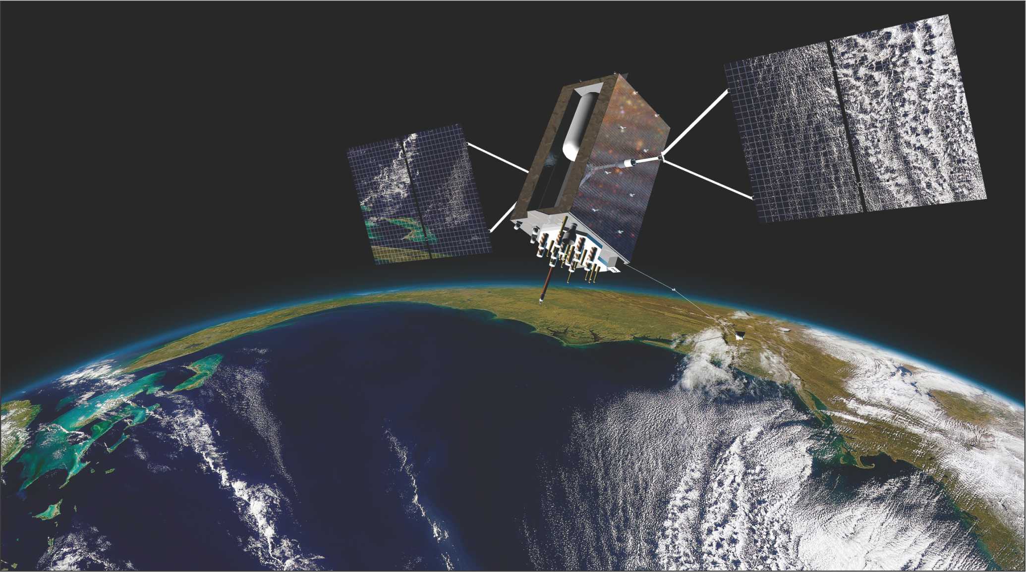
Of the three satellites planned to support Gagan, two satellites in geostationary orbit-GSAT-8 and GSAT 10- covering whole of the Indian Flight Information Region (FIA) and beyond are already in service and an in-orbit spare Gagan transponder is planned to be flown on GSAT-15. The 3150-kg GSAT-15 designed for a life span of more than 12 years would feature a two channel navigation payload to support Gagan. GSAT-15 is planned to be launched during 2014-15.
IRNSS services
Beyond Gagan, the development of India’s independent regional navigation satellite system IRNSS is proceeding apace. Two satellites-IRNSS-1A and IRNSS-1B-constituting the space segment of the seven spacecraft constellation are already in operation. IRNSS is meant to provide accurate information services to users in India as well as the region extending upto 1500-kms from its boundary. IRNSS is designed to provide two types of series-Standard Positioning Service (SPS) and Restricted Service.
While the navigation payload will be used for transmission of signals to users with an accuracy of less than 20-metres, the ranging payload will be used for the accurate range determination of the satellite. IRNSS is on the lines of American GPS, Russian Glonass, European Galileo and Chinese Beidou. Indeed, the difficulties India experienced in accessing the restricted services of GPS especially for military purpose including firing long range missiles underlined the strategic importance of a home grown satellite navigation constellation.
According to a study by Frost and Sullivan, ensuring interoperability among the global navigation satellite constellations and integrating their services was going to be a major factor in fully realizing their potentials. Experience reveals that inter operability among the global navigation constellations makes for greater reliability and enhanced accuracy.
As it is, IRNSS system has been designed to provide highly accurate position, velocity and time information services in real time and under all weather conditions round the clock. The IRNSS potentials can be profitability exploited for terrestrial, aerial and marine navigation, disaster management, vehicle tracking and fleet management, integration with mobile phones and geodetic data capabilities, navigation aid for hikers, travellers as well as visual and voice navigation for vehicle drives.
As things stand now the full fledged IRNSS constellation with seven satellites in orbit is target to be realized by 2015-16 time-frame. ISRO has hinted that depending upon the requirements in future, the seven satellite IRNSS configuration will be augmented with more spacecraft that would ultimately help expand the service area of the IRNSS constellation. A GPS satellite like IRNSS-1A transmits signals from space which are picked up and received by the ground based receivers. Each GPS receiver then provides three dimensional locations-latitude, longitude and altitude-along with the time.
For the defence forces in the thick of battlefield operations, a GPS system enables locating objects in the dark and paves way for the coordination of troop movement even in hitherto unfamiliar territory in addition to facilitating reconnaissance as well as search and rescue operations.
For the Indian defence forces the reliable and continued access to the potentials of IRNSS would be a “force multiplier” and a “game changer”. On the other hand for the proposed Indian tri-service aerospace command, access to IRNSS constellation capability along with satellites meant for other end uses including communications, weather watch and surveillance would imply a quantum leap in terms of meeting the multiple challenges of the futuristic battlefield.