Maritime surveillance through aerial, surface and sub-sea platforms have become vital tools for safeguarding nation’s maritime boundaries, maritime territories and assets as it requires round the clock surveillance over the entire maritime domain even in peace time.
Hence, the Indian Navy has been upgrading its air borne and sub sea surveillance systems over last few years at a very fast pace.
Besides illegal activities like fishing, shipping, smuggling and mining, terrorists have emerged as a major factor in maritime security who can pose threats not only to naval assets but also to other maritime assets and unprotected islands.
The terrorist attack on November 26, 2008 in Mumbai has taught a big lesson to Indian security establishment. Thus post-26/11 Indian Navy has been tasked to deter all these threats from entering Indian shore, through aerial and surface means.
For this, the Navy needs a very comprehensive and minute observation system to track the movements of small boats to larger ships in the Indian Ocean area.
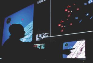
The surveillance systems assist the naval forces in taking defensive actions. After the alerts received from the sensors, the shore based installations take remedial actions.
Some of the threats are posed from nearby places whereas threats based at a long range on the surface or on flying platforms, are helpful in neutralizing the threats well in advance.
Effective surveillance
Thus for a comprehensive tracking of the threats from short range range surveillance mechanisms.
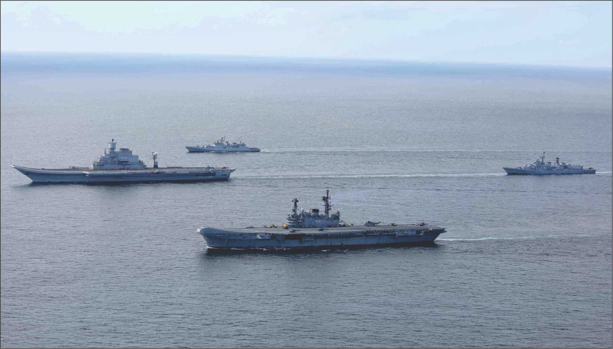
From the underwater sensors like submarine based or moored and surface ships along with airborne platforms and space borne sensors are useful in conducting maritime surveillance.
For making the surveillance systems more effective, they are required to assist in recognition, identification and location of the targets and finally in acquiring those targets.
The maritime surveillance aircrafts tracks all vessels from a long distance having long endurance.
These aircrafts carry special sensor equipments on board like radars which are tuned to detect sea targets like magnetic anomaly detector (MAD), sonobuoys, electronic support measure sensors (ESM) and environment sensors which all can function in an integrated manner for presenting a comprehensive picture of the sea by preparing a massive data base of each floating objects acquired.
In the early years, the IAF operated the liberator bombers on maritime missions for long duration missions. Later they were replaced by L-1049 super constellation which was a civilian aircraft acquired from Air India and modified for maritime reconnaissance.
These aircrafts were handed over to the Indian Navy and began independent maritime reconnaissance missions.
In the early eighties, the Navy acquired the Russian IL-38 MR aircraft and this fleet was later strengthened by eight TU-142 MR aircraft from the then Soviet Union, which were later upgraded with Israeli radar.
These long range maritime surveillance aircraft are likely to be operationally active till 2016 and to be later replaced by the American Boeing P-8I which has already started joining the fleet.
Marine UAV, Unmanned Autonomous Vehicles, will be a new element in the undersea and surface surveillance which can be deployed not only for anti-surface warfare and anti-submarine warfare but also for airborne early warning, mine countermeasures (MCM) and command and control and communications in deep waters and also in littoral waters.
This most modern system has been developed by the Indian Defence Research and Development Organisation (DRDO) and can be used in battle field surveillance, early warning and target acquisition.
Space assets
India is also working to strengthen its maritime surveillance through space based systems and the ongoing project of IRNSS (Indian Regional Navigation Satellite System) will assist in tracking vessel movements in the sea and fleet management, mapping and geodetic data.
These satellites will have Synthetic Aperture Radar (SAR) which can transmit high resolution images of less than 10 metre resolution, thus helpful in obtaining the movements of even small suspicious boats.
Optical sensors of high resolution can help in ship classification. In fact, ship detection has been seen as a potential application of satellite remote sensing.
Hence with the execution of IRNSS program Indian Navy hopes to enhance its maritime surveillance capability more minutely. The IRNSS will thus prove to be a game changer in Indian maritime surveillance capabilities.
The Indian Navy has already been equipped with an eye in the sky in the form of an indigenous GSAT-7 multi band communication satellite which was launched last year in August.
This will keep an eye on the Indian Ocean Region and help in networking all the Indian warships and aircrafts flying in the Indian Ocean Region.
The satellite called Rukmini will help Indian Navy in acquiring Blue Water capabilities and need not depend on foreign satellites like INMARSAT for communication requirements.
The threat of interdiction of maritime trade and energy looms large over the Indian Ocean and since 90 percent of India’s trade is conducted via sea, the naval forces will have to be properly equipped to safeguard India’s economy.
The Rukmini satellite will assist Indian Navy in filling a major gap in surveillance over seas by keeping a sustained watch over the movements of all warships in Indian Ocean.
On the other hand, the Indian Coast Guard has emerged as a major maritime surveillance agency in the Indian maritime area in the aftermath of 26/11 terrorist attack on Mumbai.
The infrastructure facilities for strengthening the surveillance systems of the Coast Guard have been expanding over the years and the Indian government has tasked the Coast Guard to install Coastal Static Radars.
Radar chain
Under this 46 radars, 10 on the island territories and 36 on mainland coasts for round the clock surveillance on the intruders have been installed and have been integrated into the mainland network.
The radar chains on east and west coasts besides the Andaman group of islands when fully operational hopes to provide foolproof surveillance.
As the phase-1 of the Coastal Security network gets over, the government has already sanctioned the phase-2 at a cost of Rs 650 crores.
The phase-1 expenditure was Rs 600 crores. Over 20 fast patrol boats built at Cochin Shipyards are equipped with Northrop Grumman’s Sperry Marine Vision Master, Total Watch Systems.
Thus, the Indian Coast Guard is acquiring the biggest coastal surveillance network with 46 radar stations.
Every radar station will cover an area of 25 nautical miles using radar and EO/IR sensors and focused on the area of high sensitivity and traffic density.
They are capable of interrogating class ‘A’ and ‘B’ Automatic Identification System (AIS) transponders acquired from Saab and Elcome Marine Services in a $22 million deal signed in November 2010.
These were produced in the first stage by Bharat Electronics Ltd in Rs 600 crore project.
The next stage will see existing stations strengthened with additional surveillance equipment and a further 38 coastal surveillance radar plus eight Mobile Surveillance Systems.
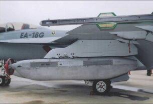
However, moving away from the coasts to high seas, the eight Boeing P-8I being inducted will prove to be a game changer in maritime surveillance over Indian Ocean and beyond.
The P-8Is will provide three tier surveillance grid in the Indian Ocean Region in conjunction with the medium range maritime reconnaissance aircraft and Israeli Searcher-2 and Heron UAVs which will provide an effective three tier surveillance grid.
The aircraft is equipped with state of the art sensors both foreign and Indian made for maritime reconnaissance, anti submarine operations and electronic intelligence missions.
The P-8I is equipped with some of the world’s most sophisticated radar and other systems especially the Raytheon made APY-10 multi-mission surface search radar with a range 200-400 km.
It also has forward looking Synthetic Aperture Radar with 240 degrees view which is built on the AESA (Active Electronically Scanned Array) technology.
For providing the rear view and ensuring 360 degree coverage, the US Telephonics has supplied a radar.
Northrop Grumman has provided the directional infrared countermeasure system and the electronic support measures system.
Thus, the P-8I will be able to detect and destroy hostile submarines and also the small boats in shallow waters which pose grave threat to Indian coastal areas and maritime assets.