Command from space
Satellites meant for a variety of end uses which serve as ‘eyes and ears’ from the commanding position of outer space, have now become indispensable for sustaining the strategic superiority of defence forces keen on realizing their mission goals, speedily and efficiently.
Indeed, space resources are being considered a ‘force multiplier and game changer’ in so far as boosting the fighting fitness of defence forces under adverse conditions is concerned.
Indeed, the massive intelligence failure suffered by the Indian Army before and during the short lived Kargil skirmish with Pakistan in 1999 has been traced to the glaring inability to access satellites designed for intelligence, surveillance and reconnaissance well on time.
Indeed, the stunning success of US led allied forces during the intervention in Afghanistan and Iraq has been traced to the extensive and intensive use of satellites. As such, today there is a growing realisation of the vital importance of space assets in realising both the tactical and strategic goals of defence forces with stunning alacrity.
As warfare experts point out, weather watch satellites predict the vagaries of weather including climatic fluctuations to facilitate the launch of high performance weapons including missiles, navigation satellites guiding lethal weapons to pre-determined targets, reconnaissance satellites locating the exact position of strategic targets, electronic ferret satellites gathering data on radar frequencies.
In also includes high resolution earth observation satellites providing an insight into military movements and defence fortification of the adversaries, advanced communications satellites providing real time, secure links between defence forces scattered over a vast geographical stretch for a coordinated strategy and ocean watch satellites snooping on the naval movement of enemies have all become an inseparable ‘celestial components’ of modern day battlefield strategy.
India is yet to put in place a dedicated military satellite for full fledged defence applications. Against this backdrop, the statement of the Indian Defence Minister A K Antony that Indian Navy will get its exclusive spacecraft to harness the potentials of final frontiers to sustain its fighting edge across the sprawling oceanic stretch to boost its mobility, strike capability and strategic superiority cannot but be a welcome development.
Strategic need
For the Indian Navy, which is keen on positioning itself as a formidable blue water force, the high performance communications satellite GSAT-7 built by the Indian Space Research Organisation (ISRO) will be of help in linking up its long range missiles, radars and air defence systems on all sea based assets to a central room through the satellite channel.
In the ultimate analysis, the satellite with over 1,000 nautical miles footprint over the Indian Ocean Region (IOR), stretching from African east coast right till Malacca Strait, will enhance the network centric capability of the Indian Navy which is not willing to be left behind in the race to acquire advanced technological tools to sharpen its fighting edge.
Interestingly, the US Navy has been in a position to dominate a large part of the oceanic waters through its “sustained and creative” reliance on a variety of advanced satellites. The long term perspective of the Indian Navy includes a well defined profile for a constellation of satellites for a wide variety of applications.
Clearly, Indian Navy needs to heighten its vigil in the vitally strategic IOR where China is fast boosting its strategic capability. And the GSAT-7, expected to be launched sometime this year, will enhance the Indian Navy’s monitoring capability in IOR.
The naval satellite is planned to be followed by the launch of space platforms for the exclusive use of Indian Army and Indian Air Force (IAF).
Till now, in the absence of dedicated satellites, Indian armed forces have been making use of the capabilities of INSAT constellation of communications satellites and IRS constellation of remote sensing satellites being operated by ISRO in a ‘limited manner’.
This is being augmented by the use of leased capability on-board the foreign satellites for purposes such as navigation, communications, surveillance and reconnaissance. However, Indian defence forces find this arrangement too inadequate to meet their fast expanding needs.
Of course, Indian Army has been using satellite capability as a primary means of communications for the troops deployed in remote and inhospitable terrain and island territories for quick reaction forces.
In particular, the Corps of Signals of the Indian Army has been falling back on INMARSAT terminals to support the contingents which form part of the UN Peace Keeping forces in many countries. Forces deployed in low intensity conflict zones are also provided with satellite based communications support.
IAF too is looking at getting a constellation of exclusive satellites for a variety of applications. The IAF’s defence “space vision 2020” outlines the need to evolve a strategy for the optimum utilization of space assets for sharpening its combat preparedness.
By all means for IAF, the uninterrupted access to dedicated constellation of military satellites is critically important for sustaining its ‘deep and long’ strike capability.
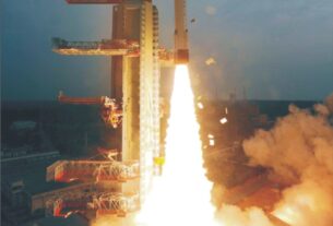
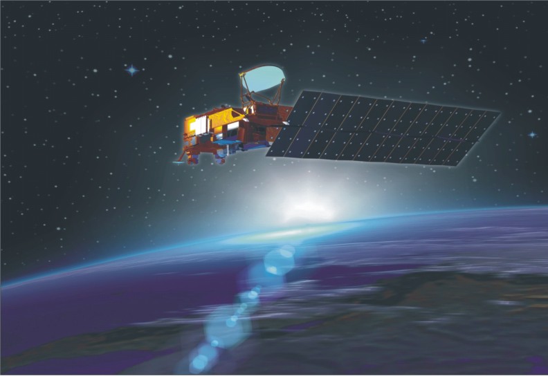
Meanwhile, the flawless launch of India’s first all weather microwave imaging satellite RISAT-1 by means of the four stage space workhorse in April this year has been described as a development of strategic significance in the context of its potentials to provide data of importance to Indian defence forces and security agencies.
Technological progress
The 1858kg RISAT-1, the heaviest Indian satellite launched from the Indian soil, while being useful for a number of civilian applications including soil moisture estimation, crop growth monitoring, food grains yield forecast and management of natural disasters, can also be harnessed for ‘surveillance and reconnaissance’ by the Indian defence forces.
For remote sensing and surveillance are considered two faces of a same coin. There is no denying the fact that the radar imaging satellites like RISAT-1 can serve as powerful tools of surveillance and as pointed out by Prof Bhupendra Jasani of the Department of War Studies at King’s College in London, can even be used for detecting naval movements.
Currently, research efforts are on to develop powerful space based instrumentation system capable of penetrating the dense thermal layers of the oceanic waters to detect the movements of submarines.
Defence analysts hold the view that Indian defence forces can very well look forward to fall back on ‘smart eye in the sky’ in the form of RISAT-1 to enhance their situational awareness and surveillance capability along India’s international borders.
For quite sometime now, the Indian Army has been seeking uninterrupted access to a range of high resolution earth imaging space platforms to obviate the repeat of Kargil like fiasco. The Cartosat series of satellites being operated by ISRO are particularly relevant to Indian defence forces for terrain modelling and understanding the landscape features in great depth.
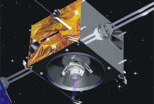
The RISAT-II satellite launched in April 2009 which ISRO had realized in association with Israel Aerospace Industries (IAI), has been widely perceived as a response to the insecurity complex generated by 26/11 Mumbai like terror attack.
Though ISRO described this radar imaging satellite as a civilian system meant to enhance Indian earth observation capability with special reference to floods, landslides, cyclones and disaster management, strategic analysts view it as a high tech space platform which has multiple defence applications including keeping a tab on terrorist movement along India’s international borders.
RISAT-II’s revisit capability of 4-5 days is considered an advantageous factor in so far as the dynamic monitoring of developments of strategic importance is considered. Added to that, the highly agile RISAT-II can be manoeuvred to change its viewing angle as per the user requirements.
Not long back, Dr V K Saraswat, chief of the Defence Research and Development Organisation (DRDO), had pointed out to a well conceived plan to build and launch a series of defence spacecraft systems with surveillance, imaging and navigation capabilities that would help keep an eye on hostile developments in the neighbourhood.
But it will also help guide the cruise missiles and high precision weapons to hit targets with a great accuracy. India has already signed an agreement with Russia for the use of its Glonass satellite navigation system for military applications.
For instance, the Indo-Russian supersonic cruise missile BrahMos can be directed to hit the designated target with a deadly impact by making use of the Glonass capability.
Meanwhile, India’s home grown seven satellite navigation system-IRNSS (Indian Regional Navigation Satellite System) is likely to be in operation in full blown configuration by the middle of this decade.
“There will be a series of defence satellites. Each year, you will find one or two going up. I can not reveal you the numbers because they are classified,” noted Saraswat.
However, he made it clear that each of these satellites would be equipped for a specific mission and would carry payloads for a variety of end uses including surveillance and reconnaissance, imaging, navigation and communications.
Going ahead, he stated that “the Army, the Navy and IAF, each have their own requirements and it would not be appropriate to say how many each of them would need”.
According to Saraswat, with these satellites in orbit, Indian defence forces would be in a position to get a holistic picture of the movement of troops and such other things in the immediate neighbourhood.
Saraswat also made a point that the satellite systems would hold the key for the successful functioning of India’s ballistic missile defence (BMD) shield. Giving details, Saraswat revealed that the roadmap of the series of satellites required by Indian defence forces has been handed over to ISRO.
Tough time
But then with its current state of infrastructure and support level, ISRO is having tough time meeting its own requirements. With a single operational vehicle in the form of the four stage Polar Satellite Launch Vehicle (PSLV) and a single launch complex spread across the island of Sriharikota on India’s eastern coast, ISRO is not in a position to accomplish more than 3-4 orbital missions in a year.
There is no denying the fact that India would need to build a second launch pad which is very critical to bolster the launch missions by a substantial extent.
China, which has three landlocked launch centres, is now building an ultra modern coastal orbital complex at Wenchang in Hainan Island which happens to be the epicentre of a massive Chinese naval build up.
By all means, the failure of ISRO to qualify the home-grown cryogenic engine required to propel the three stage Geosynchronous Satellite Launch Vehicle (GSLV) well on time could jeopardize many of the high profile projects lined up by ISRO.
Increasing demand
To meet the growing satellite needs of the Indian armed forces, ISRO would need to build not only multiple launch centres and a variety of launch vehicles equipped for varying orbital missions but also involve the Indian industry in a big way in the task of building and delivering satellites and launch vehicles in a ready to use conditions.
By all means, India clearly lacks the kind of “industrial culture” fine tuned for building spacecraft and space vehicles on a turnkey basis.
But then ISRO’s expertise could very well come in handy in the setting up of the tri-service aerospace command which is yet to receive the green signal from the power that be in New Delhi.
ISRO has a sound track record in designing and developing a state of the art satellite for a variety of applications. Incidentally, ISRO has so far built and launched more than 50 satellites for uses such as scientific research, earth observation, weather watch as well as communications, broadcasting and navigation.
But one big problem is how to associate ISRO, a civilian research organisation with the mandate to diffuse the fruits of space technology into the mainstream of national development, with the efforts to put in place a tri service aerospace command.
Indeed, for the Indian defence forces, satellites are crucial for improving the operational trimness of C4I2SR (Command, Control, Communications, Computers, Intelligence, Information, Surveillance and Reconnaissance) system.
In particular, the Indian Army is keen to use satellites to monitor the presence of missile silos, location of targets, troop deployment and movement along the borders which will facilitate combat operations.
Since the early 2007 anti satellite carried out by China, there has been a growing clamour in India for the setting up of a tri service aerospace command.
Indeed, on its part, IAF is confident that a full fledged tri service aerospace command would go a long way towards ensuring the safety of Indian space assets and guarding the Indian airspace with a heightened vigil.
By all means, an uninterrupted access to dedicated constellation of military satellites is critically important for IAF to sustain its strategic strike capability.
Evidently, satellites hold the key for coordinated and synchronized functioning of the aerospace command by seamlessly integrating weapons systems, missiles, radars, sensor suites, unmanned aerial vehicles, weaponized drones, electronics and communications network, fighter jets, transport aircraft, logistic and support systems as well as defence forces spread across a vast geographical stretch.
On another front, in the context of the anti satellite test by China, Indian defence experts have suggested the need for India to go in for both defensive and offensive space systems.
The defensive aspect involves hardening the satellites against the machinations of space based and ground based devices. The offensive component of the strategy meant to counter the threat of ‘rogue satellites’ involves deploying satellites equipped to put out of commission an enemy satellite on offensive mission.
Indeed, by knocking down the satellites through space based or ground based destructive devices, it is possible to turn the fighting force into an “impotent army”.
Rightly and appropriately, Saraswat has stressed that India should realize a mechanism to blunt the edge of hostile satellites moving in the depths of outer space.
In this context, he has hinted at the possibility of quickly assembling an anti satellite device by marrying the propulsion system of the 5,000-km range Agni-V missile that had its maiden flight in April this year with the ‘kill vehicle’ forming part of the two layered BMD shield.
Saraswat has also pointed out to the need for India to develop laser based space device to track, monitor and destroy a rogue satellite threatening the Indian space assets.
Saraswat is very clear in his perception that India should not leave anything to chance in so far as protecting its space assets is concerned. However, as things stand now it is really difficult to assess the cost involved in developing and deploying defensive and offensive space devices.
Many of the facilities and technologies already developed by ISRO, DRDO and many other research organisations, could very well be harnessed for realizing the Indian space weaponization plan, which of course, would need to be okayed by the Government, before its takes off.