Since India’s geopolitical interests are growing in the Indian Ocean region, an official estimate of just one aspect of military satellite requirement-for the Indian Navy in its Indian Ocean Region assignment-was placed at between 80 and 100 by Director General of Defence Research and Development Organisation (DRDO) Dr Avinash Chander not very long ago.
Clearly this assessment has been made to be able to monitor an oceanic expanse of 73.56 million kilometers square. Dr Chander has suggested a three dimensional capability to monitor and check the numbers and geographical locations of surface vessels and submarines using the oceans for commerce, for military purposes, tourism and travel.
In expanse it covers the Persian Gulf down to the Antarctic ice sheet in the west and Malacca Straits and the western coast of Australia in the east. Within this huge water body Indian military interest has hitherto been concentrated on the chokepoints through which ships and submarines must traverse to conduct their respective military missions.
Once inimical forces have crossed the chokepoints-Suez Canal/Red Sea, Persian Gulf, Cape of Good Hope (South Africa) in the west and the Malacca Straits and the Indonesian approach lanes in the east-there is an urgency to know what they are doing in waters that give access to Indian vital areas and vital points not necessarily confined to the maritime ambiance alone.
A case in point is the Malaysian Airlines tragedy where the airliner disappeared without trace after entering the Indian Ocean Region in an unscheduled and unannounced manner. If for no other reason than sheer curiosity the radar systems of every nation in the littoral should have become alert to the fact that an intruder/an unannounced visitor had entered their respective airspace.
China, which has about 20 satellites keeping watch over the Indian Ocean should have been the first to note that Malaysian airline had drifted off in a nearly 180 degree diversion (which by itself was suspicious and should have been investigated.) Instead China blamed Malaysia for mishandling the situation.
Given its grave concerns about piracy in and around the Malacca Strait would not at least one Chinese satellite be above South East Asia to protect Chinese national interests? The reason why the Chinese missed out could be that at that particular moment of change of direction by the Malaysian airliner the satellite placed in orbit over that region was on the other side of the globe and was, thus, on the blind side.
Continuous surveillance
This is a factor that India should take note of when designing the flight paths for future Indian satellites over the Indian Ocean Region. The configuration of the Indian satellites should be such that the areas of particular Indian interest are monitored both in day and in night on a 24 hour basis. The sea areas between these points can be monitored in a manner that shows the passage of ships and submarines of inimical nations to assist analysts about their intentions.
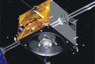
India currently has just one military satellite intended for the exclusive use of the Indian Navy-the GSAT-7 that was launched in 2013. The indigenous multi-band communications satellite is intended to help the Indian Navy keep surveillance over the Indian Ocean Region in a substantially larger framework. It will facilitate the real time networking of all the Indian warships, submarines and deck based fighters and helicopters with the onshore operational centre. The 2625 kg Rukmini, as the satellite is known, will help the Indian Navy keep an eye in the Arabian Sea and Bay of Bengal regions where arms running and sea piracy are reported with increasing frequency.
The initiation of the Indian Regional Navigation Satellite System earlier will also enable the Indian Navy not only to improve navigation under all weather conditions but enhance its situational awareness and improving the hitting accuracy of its precision guided weapons including long range missiles. To enhance its “power projection” in IOR and beyond, Indian Navy intends acquiring a constellation of exclusive satellites designed for a variety of end uses including electronic intelligence and communications intelligence.
Much of the efficacy of a satellite network system grows out of the frequency of its visitation over a particular spot which is of national interest to the nation that owns the network. A visit every twelve hours is usually accepted as adequate to keep an eye on a particular military target. This could be done during the night time because during the day human intelligence gatherers could be available to do the job. In the naval context if a ship is capable of travelling at 40 kmph it could disappear in any direction in the wide open spaces of the oceans and finding it would require additional infrastructure. That is why a constant vigil over a specific weapons platform is an ideal situation in maritime surveillance, reconnaissance and strike capability.
Improving capabilities
The DRDO chief’s assessment of a requirement of between 80 to 100 satellites to keep a watch over Indian national interests over the length and breadth of the Indian Ocean would have kept that in mind. India has been striving to achieve proficiency in both satellite creating capabilities as well as in launch vehicle technology.
Since the launch of the Aryabhata satellite on a Soviet rocket in 1975 India has been improving its technological capabilities in both satellite creation and launch facilities. It has used foreign launch sites for heavy satellites till the indigenous GSLV (geostationary satellite launch vehicle) became a success. Since 1975 total of 74 launches have taken place. There have been a few failures but nonetheless there has been an incremental improvement and success rate.
Hitherto one looks at the maritime requirement of satellite imaging. India has a large landmass and is sharing borders with Pakistan, China, Bangladesh, Nepal and Myanmar and India has cross border trouble with nearly all of the neighbors. Given the manner in which Indian boundaries are violated with impunity by Pakistan and China and there are infiltration problems with Bangladesh and Nepal, it is obvious that there is a dire need for enhancing the ground-based static defences with assistance from satellites that can give adequate real time information on threats from its neighbors.
In particular the 2,912 km of border with Pakistan is described as one of the most dangerous borders in the world. That with China (3380 km) has also been very worrisome for India over the past few years.
Given the events of the past few years-the breakdown of the ceasefire with Pakistan and the sporadic violations along the Line of Actual Control by China-demand that India has a failsafe method of surveillance and reconnaissance along both these boundaries.
An eye in the sky will ensure that day-to-day violations are contained by pre-emptive actions by India. So far India has been using the remote sensing imagery from its satellites but it needs military-specific facilities to get accurate and timely data on Chinese and Pakistani troop movements and concentrations.
Because of the problems of ground and surface clutter in the terrestrial and maritime reconnaissance domains the use of a maritime satellite over land and vice versa could become problematic.
Now that India has begun working on its own satellites it should, at an early date, be able to create military grade satellites for use over the oceans and the land borders with imagery sharp enough to tell what’s down below. Given its huge landmass and even larger maritime ambience, India needs to accelerate its military satellite projects.